We've all used a public transit router to find a quick route from A to B, such as Google Maps or CityMapper, but how do they actually work? In this post I will discuss how I tried to build my own public transport routing system for London that supports buses, tubes and trains.
The algorithm I chose to implement is called RAPTOR (Round-Based Public Transit Routing), which is a fast algorithm specifically designed for public transport routing. Unlike traditional graph-based shortest path algorithms, RAPTOR operates in rounds, where each round corresponds to one additional transit trip.
Data sources
The first challenge was getting the data. For London's public transport, I needed:
- Static timetable data (GTFS format from TfL and National Rail)
- Real-time arrival predictions (TfL Unified API)
- Live train times (National Rail Darwin API)
- Walking connections between nearby stops
For example, here's what the live train data looks like from Victoria station - you can see departures, arrivals, delays, and all the calling points:
{1 ItemstrainServices: [2 Items{}8 Items{}8 Items]}The RAPTOR algorithm
RAPTOR works by exploring routes in "rounds". In round 0, we start at our origin. In round 1, we find all stops reachable with one transit trip. In round 2, all stops reachable with two trips, and so on. The key insight is that we only need to explore trips that could potentially improve our arrival time.
The algorithm maintains the earliest arrival time at each stop. When we board a transit vehicle, we scan through its route and update arrival times at each stop along the way. If we improve the arrival time at a stop, we mark it for exploration in the next round.
Handling real-time data
The tricky part is incorporating live data. Trains get delayed, buses get stuck in traffic, and tubes have frequent disruptions. I had to build a system that:
- Fetches real-time predictions on demand
- Overrides scheduled times with live estimates
- Handles cancellations gracefully
- Caches data to avoid hitting API rate limits
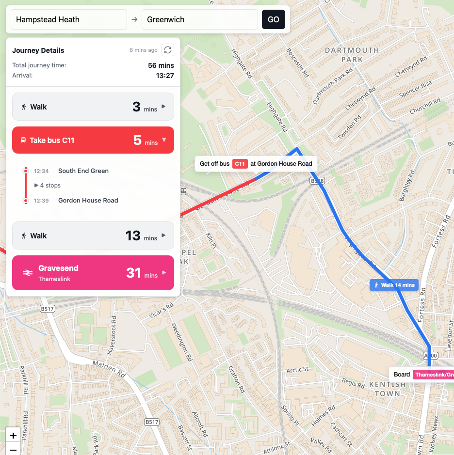
The result
After a lot of work, I have a working router that can find routes across London using live data! Here's a screenshot of the output:
The code is available on GitHub. I also made a video demo showing it in action:
Lessons learned
Building this taught me a lot about:
- Working with complex data formats (GTFS is surprisingly messy)
- Algorithm optimization (RAPTOR is fast but there's lots of room for improvement)
- API integration and caching strategies
- The complexity behind apps like Google Maps that we take for granted
If you have any questions or comments, feel free to reach out.